Location
Burnside is located in the City of Burnside council area in the Eastern suburbs of Adelaide.
Demographics
Population; 2,944
Average age; 10 to 19
| Owns outright | Purchaser | Renting | Other | Not stated |
|---|---|---|---|---|
| 43% | 35% | 19% | 1% | 2% |
| Childless Couples | Couples with Children | Single Parents | Other |
|---|---|---|---|
| 38% | 49% | 11% | 1% |
Market Insights

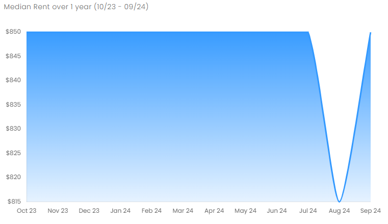
Rental Statistics
Click here to view the rental statistics report for Jul-Sep 24
Click here to view the rental statistics report for Apr-Jun 24
Click here to view the rental statistics report for Jan-Mar 24
Click here to view the rental statistics report for Jun-Sep 23
Click here to view the rental statistics report for Jan-Mar 23
Click here to view the rental statistics report for Sep-Dec 22
Click here to view the rental statistics report for Jun-Sep 22
Click here to view the rental statistics report for Mar-May 22
Click here to view the rental statistics report for Dec-Mar 22
Click here to view the rental statistics report for Jun-Sep 21
Schools
Local schools for Burnside;
- Burnside Primary School (R-7)
History
Burnside was established and named by Peter Anderson and his family who emigrated from Scotland in 1839. Anderson started a large farm on leased land near Second Creek. In 1848 the lease for the farm was assigned to William Randal who arranged for the town to be laied out around Second Creek. By the 1870s the area had developed into a small village.
There are a number of parks but most noticeably bordering several that are shared with other suburbs. Langman Reserve is part of both Burnside and Waterfall Gully and the large Newland Park has several ovals.
* Information is accurate as of September 2021 and provided by;
RP Data CoreLogic