South Plympton
Location
South Plympton is a suburb in the City of Marion council area. It is bound by the Glenelg Tram Line to the north, Marion Road to the west, and Wood Street to the south; it has a slightly complicated eastern boundary which includes Towers Terrace and Winifred Avenue.
Demographics
Population; 4,172
Average age; 20 to 39
| Owns outright | Purchaser | Renting | Other | Not stated |
|---|---|---|---|---|
| 32% | 34% | 29% | 4% | 3% |
| Childless Couples | Couples with Children | Single Parents | Other |
|---|---|---|---|
| 42% | 41% | 15% | 2% |
Market Insights

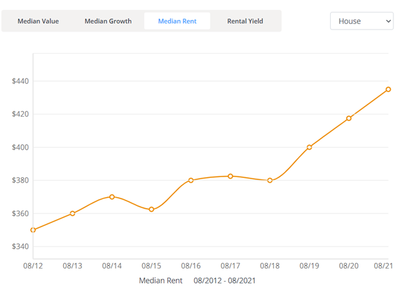
Rental Statistics
Click here to view the rental statistics report for Jun-Sep 23
Click here to view the rental statistics report for Sep-Dec 22
Click here to view the rental statistics report for Jun-Sep 22
Click here to view the rental statistics report for Mar-May 22
Click here to view the rental statistics report for Dec-Mar 22
Click here to view the rental statistics report for Sep-Dec 21
Click here to view the rental statistics report for Jun-Sep 21
Schools
Local schools for South Plympton;
- Forbes Primary School (R-7)
- SEDA College SA - South Plympton Campus
- Emmanus Christian College (R-12)
History
The suburb was originally divided into small suburbs including Forbes, Harcourt Gardens and Vermont, which were amalgamated into South Plympton in 1947.
* Information accurate as of September 2021 and provided by;
Australian Bureau of Statistics
RP Data CoreLogic