McLaren Flat
Location
McLaren Flat is a township in the McLaren Vale/Willunga basin south of Adelaide. It is on the sprawling flat land to the east of the town of McLaren Vale and on the road to Kangarilla.
It is bounded by Kays Road, Beltunga Road, Blewitt Springs Road, Douglas Gully Road, Clayton Road and McLaren Flat Road in the north, Toops Hill Road, Wickham Will Road and Range Road in the east, the locality of The Range, Trustcott Road, Oakley Road and Sand Road in the south, and Foggo Road in the west.
Demographics
Population; 1,511
Average age; 40 to 49
| Owns outright | Purchaser | Renting | Not stated |
|---|---|---|---|
| 29% | 55% | 14% | 2% |
| Childless Couples | Couples with Children | Single Parents | Other |
|---|---|---|---|
| 34% | 57% | 10% | 1% |
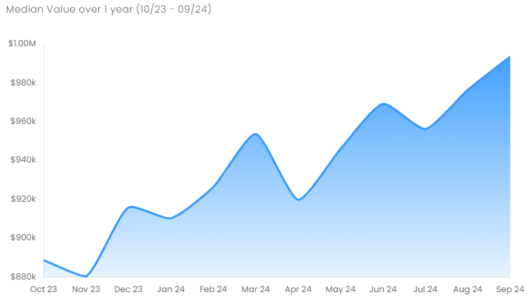
Market Insights

Rental Statistics
Click here to view the rental statistics report for Jul-Sep 24
Click here to view the rental statistics report for Apr-Jun 24
Click here to view the rental statistics report for Jan-Mar 24
Click here to view the rental statistics report for Jun-Sep 22
Click here to view the rental statistics report for Mar-May 22
Click here to view the rental statistics report for Sep-Dec 21
Click here to view the rental statistics report for Jun-Sep 21
Schools
Local schools for McLaren Flat;
- McLaren Flat Primary School (R-7)
Fun Facts
McLaren Flat is part of the McLaren Vale wine region. The area surrounding the town is planted to vineyards and home to several wineries and cellar doors.
McLaren Flat has its own primary school, however all of the town's sports teams are joined with the neighbouring town of McLaren Vale and known as McLaren Districts.
* Information is accurate as of September 2021 and provided by;
RP Data CoreLogic
-
Education
- Blewitt Springs School
- McLaren Flat Primary School
- Tsong Gyiaou
-
Recreation
- Manning Fauna and Flora Reserve
- Park Hill Sanctuary